Publisher reference, retrieved 21 November 2026. Dataset source revision: 4b414d527a2971ee9baebe2745447f95ac1fc535. Original source (dataset-file access may require approval). Download Markdown.
Image sources and attribution
Publisher: Gagandeep Reehal, INDUS-AD. These preview collaterals are reproduced unchanged under CC BY-NC 4.0. Website logos are separate generated brand artwork.
The public assets repository is separate from the gated dataset payloads. Main-release preview images are pinned to revision 8fedf72d9acdb02d7433e55320c4bb6a3055c9ed.
| Website image | Public original |
|---|---|
| surround-view.png | View original |
| dataset-layers.png | View original |
| coverage-map.png | View original |
| driving-conditions.png | View original |
| research-policy.png | View original |
| explore-layers.png | View original |
| research-directions.png | View original |
| sensor-layout.png | Public devkit copy |


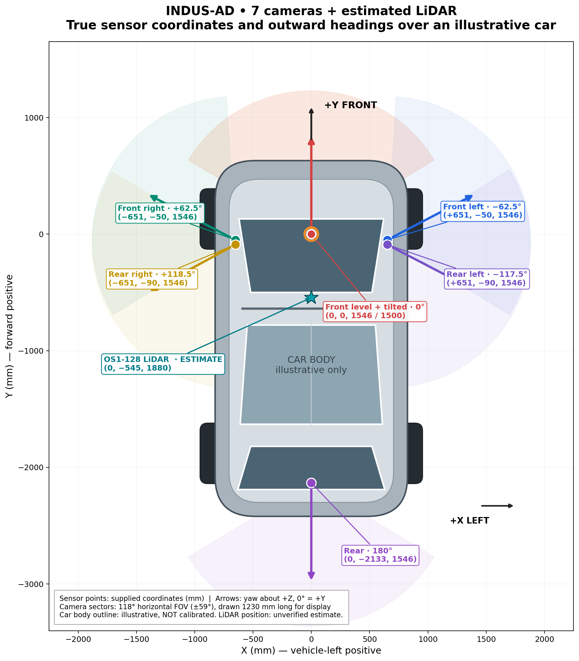
The sensor illustration is not to scale and retains an older rear-right yaw value. Use current numeric geometry and calibration documents for computation. Examples and route-density imagery describe a regional collection and do not establish balanced geographic/weather coverage or privacy performance.
Website banner adaptation
The edge-to-edge banner is a presentation adaptation of the publisher’s surround-view collage. Its title strip was removed with AI-assisted reconstruction. It is illustrative and should not be used as an unmodified dataset frame or measurement reference. The original surround-view asset remains available in the website assets.