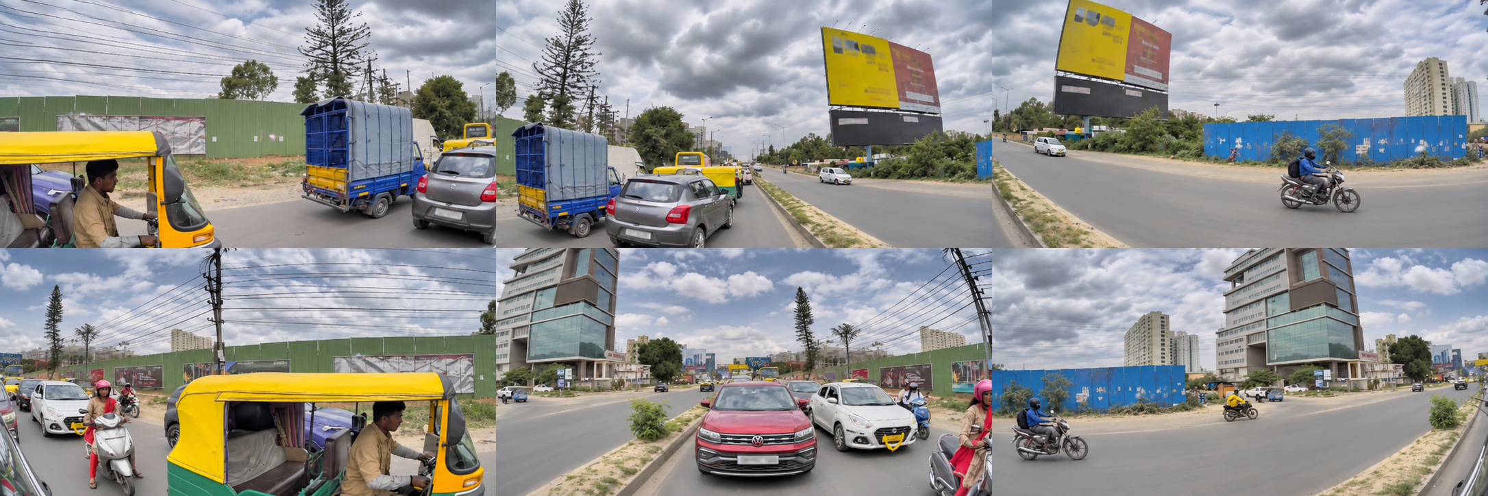
Presentation collage of Bengaluru road views, adapted from publisher camera previews

Indian roads.
Real-world complexity.

INDUS-AD: Indian Dataset of Unstructured Urban Scenes for Autonomous Driving

By Gagandeep Reehal

The largest Indian autonomous driving dataset.

Multi-camera video, vehicle motion and scene signals from Bengaluru, India—connected for autonomous driving research.

INDUS-AD Multi-camera

1,469driving recordings
9,927camera MP4s
85.31 hrecording timeline
588.57 hsummed camera-view time

INDUS-AD Monocam Single-camera

96single-camera recordings
2.93 hindexed source-camera time
105,692decoded camera frames

INDUS-AD 3D LiDAR

8shared recordings
76,052indexed LiDAR scans
31LiDAR payload TAR shards

Figures from the published dataset cards. Camera-view time sums multiple perspectives on the same drives.

Indian driving deserves direct study.

A dataset for understanding how vehicles see and move through unstructured urban scenes.

A two-wheeler moves alongside a car. An auto-rickshaw enters the junction. Traffic negotiates space on a road where lane markings explain only part of what happens next. For anyone who has driven in Bengaluru, these interactions are familiar. For a model learning to understand driving, they are a demanding part of the world to represent.

The dataset brings together recorded camera video, timing and calibration tables, privacy-transformed GNSS/pose information, and sampled semantic and depth outputs. The aim is to give researchers a practical starting point for studying Indian traffic with data collected in that setting.

The main release contains approximately 4.006 TB in familiar MP4 and Parquet formats. Each recording has a stable recording_id connecting its different layers. You can explore a recording, choose the streams and time windows your experiment needs, and construct a task-specific subset without treating the entire collection as one download.

The audience includes researchers in autonomous driving, robotics, computer vision, video representation learning and data infrastructure. INDUS-AD provides observations and derived signals; researchers choose their own targets, filtering, synchronization and evaluation partitions.

One recording.
Six perspectives.

Watch 15 seconds of Bengaluru driving across the six surround cameras. The views follow the same recorded frame IDs, with each camera labeled.

Front left · Front · Front right / Rear left · Rear · Rear right
Download videoClip details

More than a view
through the windshield.

A front camera tells only part of the story. A rider approaches from the side, a vehicle closes from behind, and a turn changes which view matters next.

Six surround views, plus a tilted front view

Front, front-left, front-right, rear, rear-left and rear-right video are present in all 1,469 main-release recordings. The additional tilted-front stream is available in 1,113 recordings; its absence in the remaining 356 is represented as missing data.

Multiple cameras provide complementary views of the same driving interval, supporting experiments that use the scene around the vehicle.

Main-release camera availability
CameraRecordings
Front1,469
Front left / front right1,469 each
Rear / rear left / rear right1,469 each
Tilted front1,113

Source: main dataset card. Inspect individual recording metadata before selecting streams.

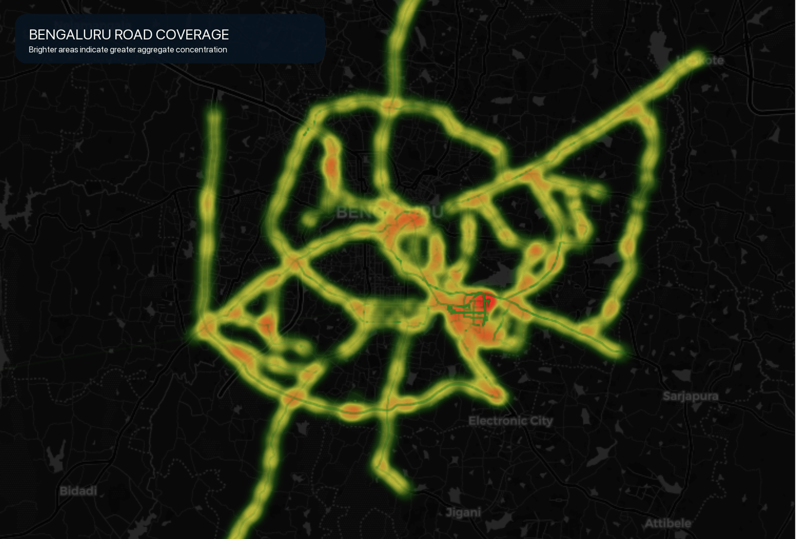
Aggregated route-density map across Bengaluru and surrounding road corridors
Bengaluru route density. Brighter areas show a greater concentration of recorded routes.

One regional setting, explored in depth

The recordings cover Bengaluru and its surrounding road network. They offer a setting for studying mixed traffic, road-user interactions, changing scene context and the practical difficulties of working with real sensor recordings.

Repeated routes and neighboring clips can share context. Evaluation partitions should account for recording identity, temporal adjacency and scene or trajectory overlap.

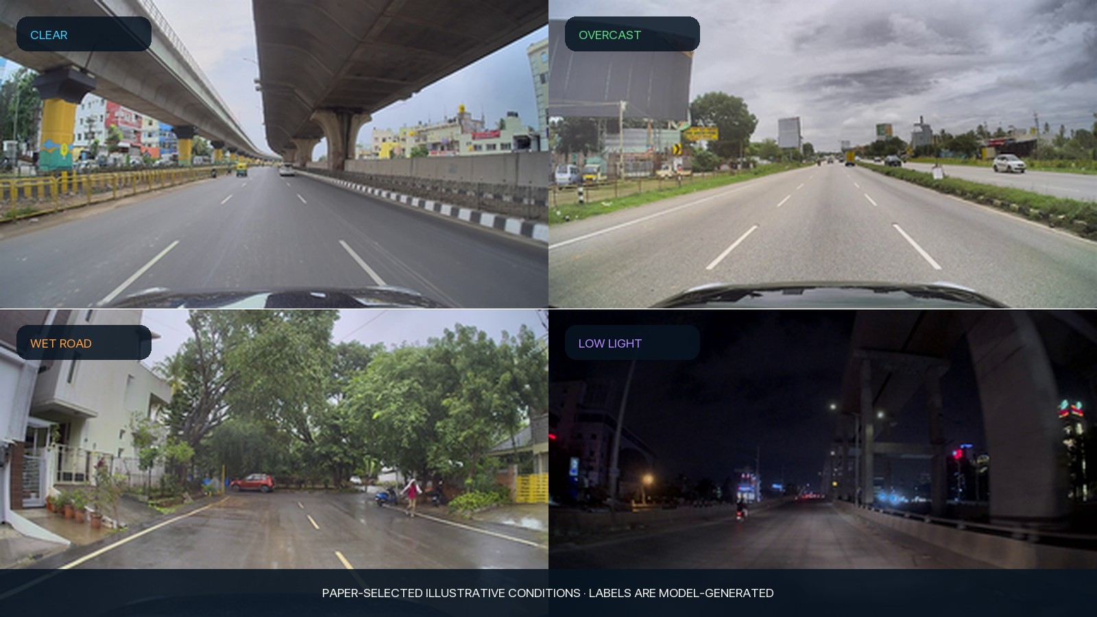
Four recorded road examples showing clear, overcast, wet-road and low-light scenes
Examples of clear, overcast, wet-road and low-light conditions from the publisher’s research collateral.

Video, motion and scene signals.
Connected by recording.

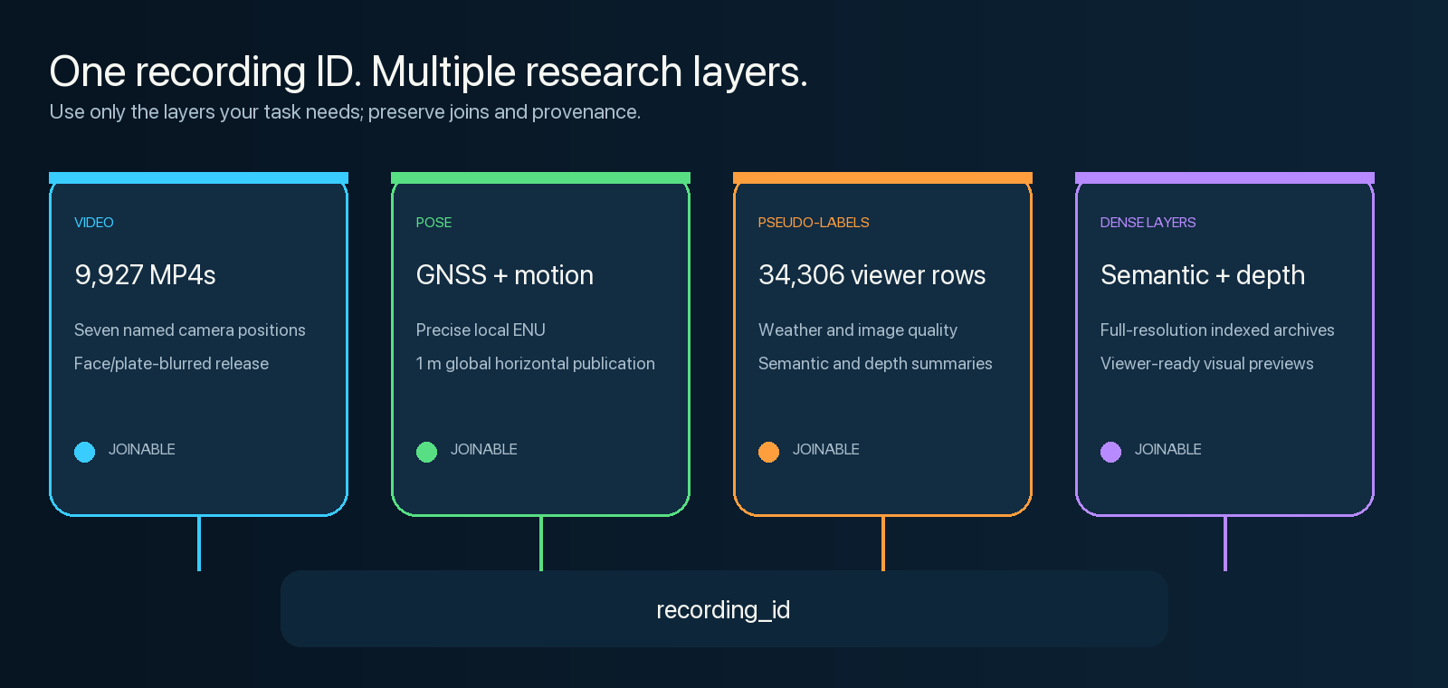
Start from the layer your question needs, then join deliberately. File counts, message counts and sampled labels describe different units.

Video and normalized sensor tables

The main release contains 9,927 MP4 files and matching camera-frame tables, plus 1,469 GNSS recording tables. Camera timing, calibration, motion, orientation, validity and sensor-quality fields make it possible to inspect the relationships behind a clip.

Normalized GNSS tables include channel identity, motion and sensor-quality fields. See the sensor reference for stream-specific analysis.

Sampled semantic and depth outputs

The 34,306 sampled camera-annotation rows include semantic class fractions, depth summaries, weather scores and image-quality features. Dense indexes connect these samples to semantic masks and depth maps in TAR archives.

Browse semantic and depth previews in the Viewer, or use the indexed archives for full-resolution outputs.

Video, GNSS and motion, pseudo-labels and dense outputs joined through recording_id
Video, motion and derived scene layers connected through recording identity.

Sampled, model-generated annotations

Semantic, depth and weather outputs are sparse pseudo-labels rather than human-verified ground truth. Coverage varies by camera and recording; check the published coverage guide when selecting supervision.

Read annotation coverage and exact-join examples
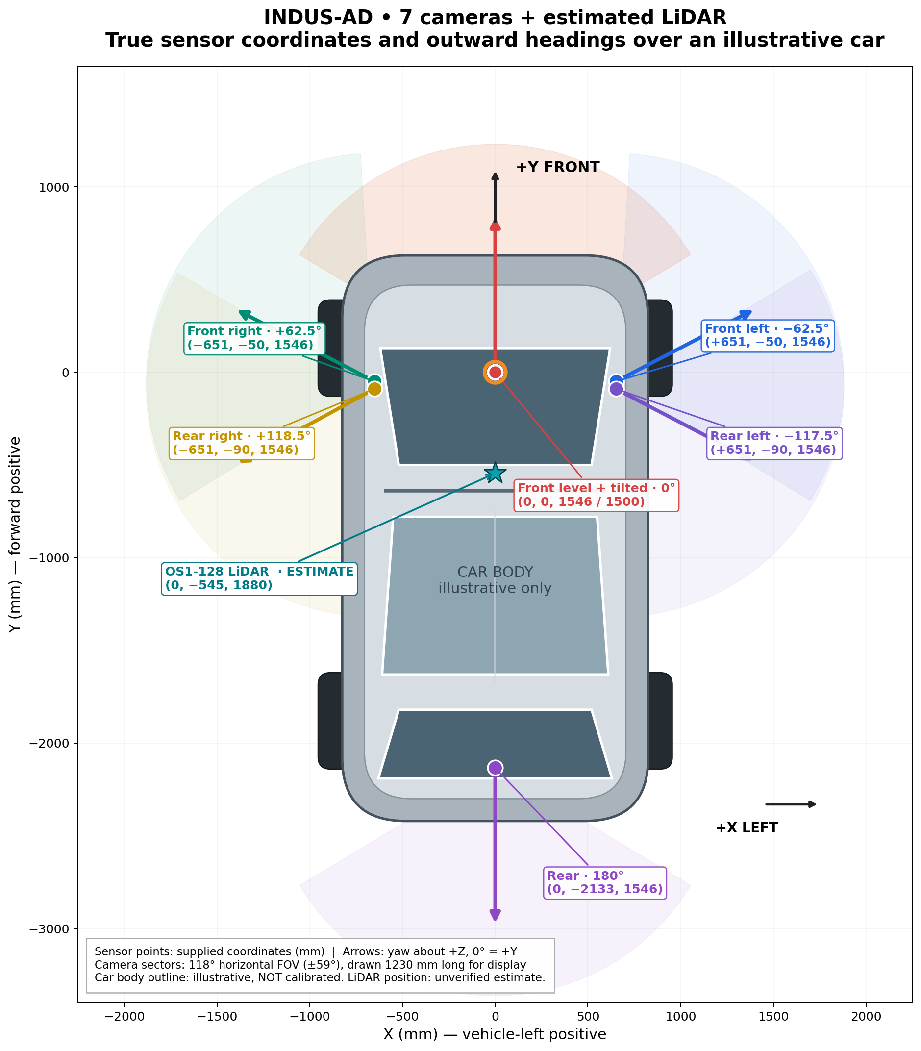
Publisher illustration of seven camera positions and an Ouster OS1-128 LiDAR on a vehicle
Seven-camera and LiDAR rig illustration. See the mounting geometry reference for current numerical parameters.

Documented sensor geometry and timing

The reference documents define camera mounting coordinates, optical projection parameters, coordinate frames, units and transform direction.

Camera and GNSS timing policies, calibration conventions and missing-data handling are documented alongside the release.

Sensor and timing reference · Mounting geometry

Different questions.
A shared starting point.

Build task-specific experiments across video learning, motion, perception and robotics data infrastructure.

Video and world models

Explore temporal representations, future visual prediction and self-supervised learning from driving sequences. Multiple views support questions about relationships across cameras, while real traffic supplies changing interactions and scene context. Choose clip duration and sampling frequency to match the hypothesis.

Pose-derived trajectory research

Use video and valid pose histories to investigate future-motion targets or trajectory-oriented imitation learning. Document timing, coordinate frames, gap handling and target construction.

Perception and weak supervision

Study multi-camera context, sparse semantic/depth outputs and ways to select useful frames from longer recordings. Evaluate pseudo-label quality for your chosen task.

Localization and data tooling

Investigate GNSS/camera association, missing streams, timing gaps, quality filters and reproducible data selection. Preserve channel identity and validity flags.

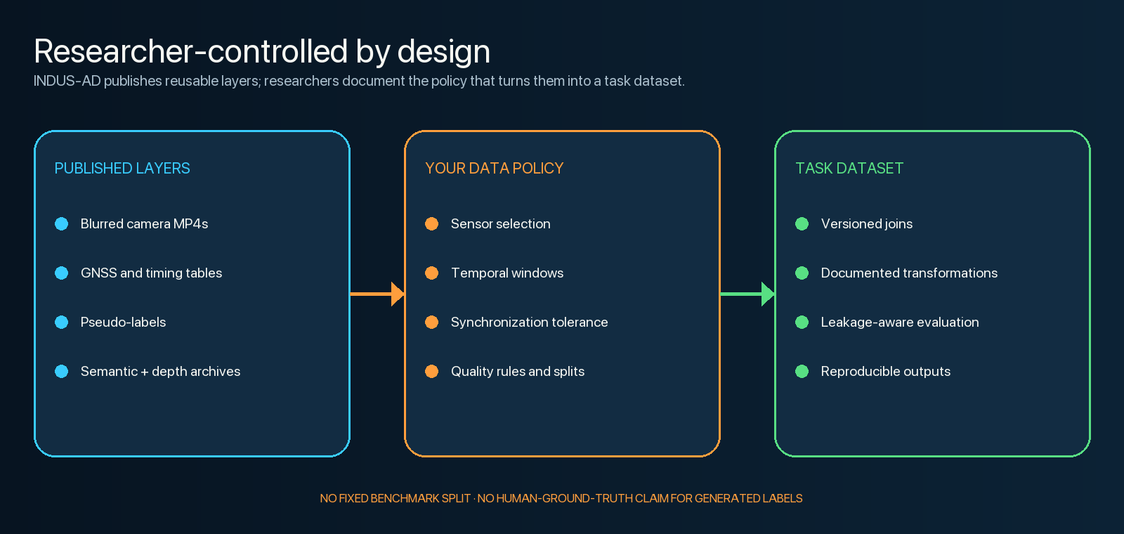
Published dataset layers feed a researcher-defined policy to create a versioned task dataset
Define and record the policy that turns published observations into your experiment’s data.

Choose your starting point.

Explore the main multi-camera release and its single-camera, LiDAR and sample companions.

INDUS-AD

Multi-camera video, GNSS and derived perception layers

The main camera/GNSS release: 1,469 recordings, 9,927 MP4s, 85.31 timeline hours and approximately 4.006 TB. Choose it for surround-view experiments and access to the wider set of normalized tables, sampled labels and dense references.

Six surround cameras are available across the release, with an additional tilted-front stream in a subset. It contains no LiDAR payloads. Access requests are reviewed manually.

Explore INDUS-AD

INDUS-AD Monocam

A separate single-camera release

Monocam contains 96 front-camera MP4s and 105,692 decoded frames, with normalized sensor tables, 10,608 sampled frame-label rows and semantic/depth archives. The decoded release is approximately 36.02 GB, including 22.85 GB of video.

A smaller entry point for monocular perception and video workflows. Download selected MP4s for local playback if your browser does not support HEVC.

Explore Monocam

INDUS-AD 3D

The decoded LiDAR companion

The 3D release provides 76,052 indexed LiDAR scans for eight recordings shared with the main dataset, distributed across 31 payload TAR shards with recording, scan and calibration indexes. Join by exact recording_id, then assess timing for your task.

Use the main release alongside this LiDAR companion for camera and GNSS data. The current devkit supports the camera/GNSS workflow; LiDAR access uses the companion’s scan indexes and archives.

Explore the LiDAR companion

INDUS-AD Sample

A smaller selection of the main release

Explore eight complete recordings and 55 camera videos—16 minutes 43.7 seconds of driving—with matching GNSS tables and sampled semantic/depth outputs. The complete selection is about 9.53 GB.

Explore the sample

View the publisher’s Hugging Face collection. Release-specific counts and access details above were checked against current cards and metadata on 21 November 2026.

INDUS-AD in context.

Compare the geography, released data, scale and access terms of major driving datasets.

Published driving datasets: scope, release scale and access
Dataset Geography/scope Released data and recording length Published size Access/license Comparison note
INDUS-AD Bengaluru, India 1,469 recordings; 85.31 h released timeline; 588.57 summed camera-view h About 4.006 TB encoded release Manual gate; CC BY-NC 4.0 9,927 camera MP4s and normalized GNSS/calibration tables. Source and decoded representations overlap and must not be added.
NVIDIA PhysicalAI Autonomous Vehicles Global, 25 countries 1,700 h; 306,152 20-second clips 133 TB Gated; NVIDIA AV Dataset License Multimodal clips, not India-focused.
OpenDV-2K / OpenDV-YouTube Global, 244+ cities More than 1,700 h in reproducible YouTube component About 3 TB video; about 24 TB processed images Source-reproducible; underlying source terms Website video list; full-suite collection and reproducible component are distinct.
nuPlan Four international cities More than 1,300 h; 15,000+ logs No single directly comparable total stated in cited overview Registration; dataset terms Planning logs and sensor packages have different scope.
BDD100K United States 100,000 approximately 40-second videos; more than 1,000 h Not stated in cited overview Dataset terms Independent videos; not India-focused.
Waymo Open Motion United States 574 scenario-hours; 103,354 20-second segments Not stated in cited overview Dataset license Scenario time, not continuous road-coverage time.
Argoverse 2 Sensor United States 4.2 h; 1,000 approximately 15-second scenes 1 TB extracted CC BY-NC-SA 4.0 Selected multimodal scenes.
IDD-3D Hyderabad, India Publisher reports over 5 h; 12,000 annotated LiDAR frames 236 GB Project access; dataset terms Camera/LiDAR corpus; annotated-frame count is separate from recording length.
ThirdEye Indian Road Dataset Delhi NCR, India 645,714 annotated keyframes; released continuous video duration not stated About 210 GB CC BY 4.0 Image/mask/annotation TARs and GPS; continuous video is not listed.
METEOR India 1,250 one-minute videos; approximately 20.83 h Approximately 100 GB reported Dataset terms Annotated traffic videos with GPS trajectories and traffic-behaviour labels.
India Driving Dataset / IDD India 117K-image portal release; continuous video duration not stated 72 GB for IDD 117K Registration; research terms Image-centric subsets; raw collection time is not a released-video duration.
DriveIndia / TiHAN camera release India 66,986 annotated images reported; 120+ h describes collection, not verified released continuous footage Not stated EULA and access request Official conference abstract separates selected images from 120+ collection hours.
TIAND / TiHAN multimodal India Download request offered for 2–4-minute scenes; complete released duration not stated Author repository describes a roughly 37 GB sample Usage agreement and approval 60 TB is advertised as collection size; complete released duration is unspecified.

Reproduced from the INDUS-AD dataset card; source comparison checked 16 October 2026. Released timeline, summed camera-hours, scenario-hours and image counts describe different units. Unknown released durations remain unranked.

Start with one recording.
Scale when the workflow works.

A multi-terabyte release does not require a multi-terabyte first experiment.

  1. Pick the release and review access

    Choose a dataset card, review its license and request access where required.

  2. Inspect the layers separately

    Browse recordings, camera annotations, GNSS and semantic/depth previews in the Viewer, or work directly with the published files.

  3. Pin a revision and download selectively

    Choose a recording, pin its dataset revision and download the videos, tables or dense layers your experiment needs.

  4. Define and validate your experiment

    Set your sampling and evaluation policy, inspect the selected output, then expand to a larger subset.

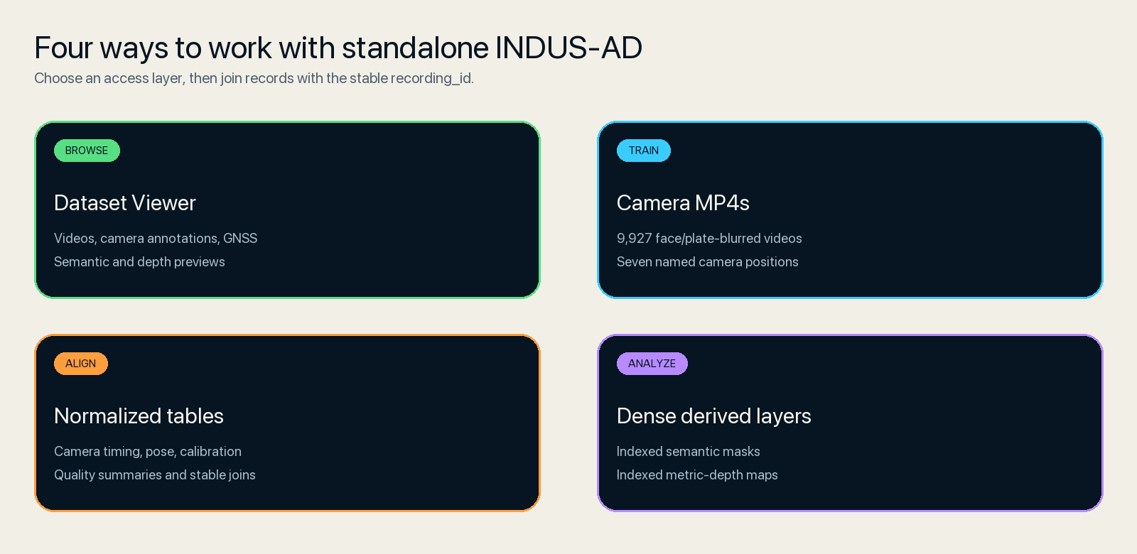
Four access routes: Dataset Viewer, camera MP4s, normalized tables and dense semantic/depth layers
Choose an access path suited to your experiment rather than downloading every layer at once.

From recordings to reproducible subsets.

The INDUS-AD devkit selects frames and scenes, interpolates GNSS poses, applies filters and scenario quotas, and exports validated train/test subsets with provenance in a nuScenes-compatible structure.

A practical first build

The six-camera quickstart selects approximately 209 MB of source artifacts and produces one scene, 48 samples and 288 images. Follow the quickstart guide for setup and working-space requirements.

What compatibility means

Exports follow the nuScenes file structure and supported loader behavior. This format compatibility does not add nuScenes annotations, maps or benchmark partitions.

Use Python 3.12 on Linux or macOS. The devkit supports camera/GNSS data; LiDAR ingestion is not included. Software and dataset licenses are listed in their respective repositories.

Production validation · Source compatibility · Troubleshooting

The details behind the data.

Schemas, sensor conventions, calibration references and practical guidance for working with the data.

Each page links to its original source and records the revision used. Read the reference documents directly on this website.

Research use.
Responsible access.

Useful data needs clear limits, traceable sources and a route for concerns.

Licensing and access

Published dataset releases use CC BY-NC 4.0 for non-commercial use, subject to their individual access requirements. Attribute the source and identify the release used. For raw recordings or commercial use, contact the author about a separate license.

Privacy transformations and residual risk

Published videos use automated face and plate blur, and GNSS publication reduces global position precision while retaining local motion geometry. These transformations do not guarantee anonymity. Do not re-identify or track people or expose sensitive locations.

Report concerns privately

Send privacy or takedown concerns privately to indus-ad@gagandeepreehal.com, including the recording ID or artifact path when known.

Evaluation and deployment limits

Researchers define their own train, validation and test partitions; Viewer split names are publication labels. The releases are intended for research, not validated production driving or safety decisions.

Read the complete privacy and takedown policy

Raw recordings &
commercial licensing.

Need raw source recordings for an appropriate use case, or a commercial license for your product or research programme? Contact Gagandeep Reehal to discuss licensing options.

Share your organisation, intended use, data requirements and preferred scope. Availability, permitted uses and pricing are agreed case by case under a separate license.

Get in touch.

Questions about the data, research collaborations or feedback on the tools? Contact the author.

Gagandeep Reehal

Author and publisher of INDUS-AD

indus-ad@gagandeepreehal.com

For privacy or takedown requests, email the same address privately with the recording ID or artifact path.

Cite the resources you use.

Use the citation for each dataset release used in your work, and cite the devkit separately when using its software.

INDUS-AD

Gagandeep Reehal. 2026. INDUS-AD: Indian Dataset of Unstructured Urban Scenes for Autonomous Driving. Hugging Face dataset.

BibTeX
Download .bib
@dataset{indus_ad_2026,
  author    = {Gagandeep Reehal},
  title     = {INDUS-AD: Indian Dataset of Unstructured Urban Scenes for Autonomous Driving},
  year      = {2026},
  publisher = {Gagandeep Reehal},
  url       = {https://huggingface.co/datasets/gagandeepreehal/indus-ad}
}

INDUS-AD 3D

Gagandeep Reehal. 2026. INDUS-AD 3D: LiDAR companion to INDUS-AD. Hugging Face dataset.

BibTeX
Download .bib
@dataset{indus_ad_3d_2026,
  author    = {Gagandeep Reehal},
  title     = {INDUS-AD 3D: LiDAR companion to INDUS-AD},
  year      = {2026},
  publisher = {Gagandeep Reehal},
  url       = {https://huggingface.co/datasets/gagandeepreehal/indus-ad-3d}
}

INDUS-AD Monocam

Gagandeep Reehal. 2026. INDUS-AD Monocam: Decoded Single-Camera Driving Dataset. Hugging Face dataset.

BibTeX
Download .bib
@dataset{indus_ad_monocam_2026,
  author    = {Gagandeep Reehal},
  title     = {INDUS-AD Monocam: Decoded Single-Camera Driving Dataset},
  year      = {2026},
  publisher = {Gagandeep Reehal},
  url       = {https://huggingface.co/datasets/gagandeepreehal/indus-ad-monocam}
}

INDUS-AD Devkit

Gagandeep Reehal. 2026. INDUS-AD Devkit. Version 0.1.2. GitHub software.

BibTeX
Download .bib
@software{indus_ad_devkit_2026,
  author    = {Gagandeep Reehal},
  title     = {INDUS-AD Devkit},
  year      = {2026},
  version   = {0.1.2},
  url       = {https://github.com/gagandeepreehal/indus-ad-devkit}
}

Include the dataset revision and any devkit version used in your experiment.